
There are projects which, due to their relevance or complexity, require an in-depth knowledge of the above-ground structures and underground networks. This knowledge can be reached by using the technologies available for 3D laser scanning surveying and for underground utility mapping and integrating information into a single three-dimensional information model. The model can be produced in a parametric CAD and/or BIM format and is the best basis on which to develop a project, both in the civil and industrial sectors.
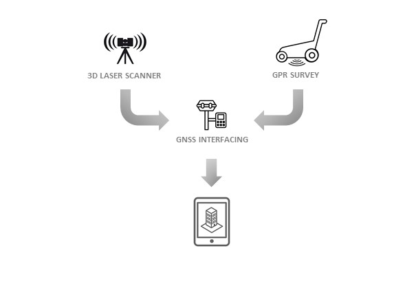
The survey can be carried out simultaneously with two work teams, one dedicated to the laser scanner and the other to the GPR. Alternatively, the measurements can be made at different times since the reduction to a single reference system is obtained by using GNSS receivers interfaced with the relevant instrumentation. There are also mobile mapping systems that integrate all the instrumentation allowing the complete survey with a single acquisition operating unit.
The acquired data are subsequently subjected to specific processing procedures and integrated into a single three-dimensional georeferenced development environment. All the available information can be linked to the modeled/interpreted geometries and the final result is a single digital 3D model of the site to be used for the design. The 3D model can be saved in IFC standard formats and imported into all softwares for BIM design.
A combined 3D model of the above ground structures and of the underground allow to centralize all information on the site and to make it available to all the designers involved. In the BIM context, the 3D survey is the ideal starting point for most relevant projects and is fundamental for the as-built documentation.
3D surveying requires the use of many technologies and ENVIA is among the few organizations to have the skills and instruments to carry out this service in its entirety without resorting to subcontracting.