
Geospatial data storage has proven to be a very effective way of sharing information and managing assets within various organizations. For years the use of geodatabases and GIS platforms has been relegated to market niches, but it is proving increasingly strategic and maintains a high development potential that is still unexpressed. The spread of high-speed connections and increasingly high-performance mobile devices is opening extraordinary opportunities for the use of geodata in the management of many business processes and even in the direct relationship with the customer.
In this area, there are advanced open-source software platforms and tools, functional and supported by large international development and use communities. These allow you to create tailor-made solutions for any need by investing all resources on development without license costs.
As far as geodatabases are concerned, the most complete solution is PostgreSQL in combination with its spatial extension PostGIS. The most widely used open-source Desktop GIS application is definitely QGIS which allows the development of custom plugins based on Python code. Remaining in the sphere of Python, it is possible to use frameworks for the development of Web applications, among which the most used are Django and Flask.
Envia has developed internally applications for the management of geo-environmental data, for underground utility mapping and for design in the field of telecommunications, with the aim of optimizing processes and offering improved services to its clients.
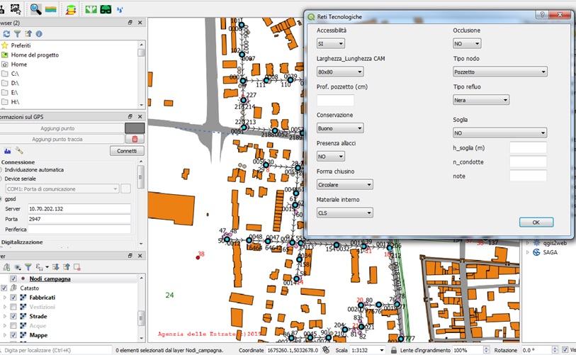
In the last years, Envia has transformed the direct experience on its projects and processes into a package of application development services on the Desktop, WebGIS and Mobile platforms to support consultancy and surveying activities. With these services we want to transfer to our customers all the advantages that can be obtained from the management of documents, data and design processes based on their specific needs on a corporate and individual project scale.